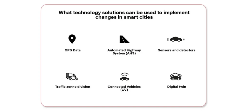
Cities of the future are spaces that are comfortable to live in, eco-friendly, safe, and intelligently managed. It’s hard to imagine such a futuristic scenario without the use of advanced technology. Preferably one that combines various elements within one coherent data processing system. Especially great potential lies in solutions at the crossroads of automotive, telematics, and AI. Let’s dive into the transport in cities of the future.

GPS data
GPS technology gives developers the ability to monitor the vehicle position in real-time, and on top of that generate the data on parameters such as speed, distance, and travel time. Using this kind of telemetry information, combined with fuel level, speed limits, traffic information, and the estimated time of arrival, the urban transportation passengers can be instantly alerted to ongoing, but also predicted delays and problems on route.
An advanced version of this system can also propose different routes, to avoid building up traffic in congested areas and reduce the average travel time of the passengers, making everyone happy.
Sensors and detectors
Installed along roads, such elements collect data on traffic volumes, vehicle speeds, and which lanes are being occupied. Sensors embedded in roads are used today by about 25% of smart city stakeholders in the United States (Otonomo study).
Additionally, the so-called agglomerative clustering algorithm helps to identify clusters of places or destinations.
Connected Vehicles (CV)
The latest generation of intelligent transportation systems works closely with the Internet of Things (IoT), specifically the Internet of Vehicles(IoV). This allows for increased efficiency, mobility, and safety of autonomous cars.
Wireless connectivity provides communication in indoor and outdoor environments. There is possible interaction:
- Vehicle-to-vehicle (V2V),
- Vehicle to Vehicle Sensor (V2S),
- Vehicle-road infrastructure (V2R),
- Vehicle-Internet (V2I).
In the latter case, the vehicle couples with ITS infrastructure: traffic signs, traffic lights, and road sensors.
Digital twin (case study: Antwerp)
A digital twin is a kind of bridge between the digital and physical worlds. It supports decision-makers in their complex decisions about the quality of life in the city, allowing them to budget even more effectively.
In the Belgian city of Antwerp a digital twin, a 3D digital replica of the city, was launched in 2018. The model features real-time values from air quality and traffic sensors.
The city authorities can see exactly what the concentration of CO2 emissions and noise levels are in the city center. They also notice to what extent limited car traffic in certain city areas affects traffic emissions.
Automated Highway Systems (AHS)
Connected vehicles have opened the way for further innovations. Automated highway systems will be among them. Fully autonomous cars will move along designated lanes. The flow of cars will be controlled by a central city system.
The new solution will allow the causes of congestion on highways to be pinpointed and reduces the likelihood of collisions.
Traffic zone division
Traditional traffic zoning takes into account the social and economic factors of an area. Whereas today, this can be based on much better data downloaded in real-time from smartphones. You can see exactly where most vehicles are accumulating at any given time. These are not always “obvious” places, because, for instance, at 3 p.m. there may be heavier traffic on a small street near a popular corporation than on an exit road in the city center.
This modern categorization simplifies the city’s complex road network, enabling more efficient traffic planning without artificial division into administrative boundaries.
Possibilities vs. practice
There are some interesting findings from a study conducted in 2021 by the analytics firm Lead to Market. It aimed to determine how cities are using vehicle data to enhance urban life. Today, these are being used for:
- alleviating bottlenecks in cities for business travelers and tourists (36%),
- better management of roads and infrastructure (18%),
- spatial and urban planning (18%),
- managing accident scenes (14%),
- improving parking (6%),
- mitigating environmental impacts (2%).
Surprisingly, however, only 22% of respondents use vehicle data for real-time daily traffic management. What could be the reason behind this? Ben Wolkow, CEO of Otonomo, points to one main reason: data dispersion. Today, it comes from a variety of sources. Meanwhile: for connected vehicle data to power smart city development in a meaningful way, they need to shift to a single connected data source.
It’s good to know that data from connected vehicles currently account for less than one-tenth of smart city analysis. But experts agree that this will be changing in favor of new solutions.
Technology that shapes the city
Vehicles are becoming increasingly intelligent and connected. Hardware, software, and sensors can now be fully integrated into the digital infrastructure. On top of that, full communication between vehicles and sensors on and off the road is made possible. Wireless connectivity, AI, edge computing, and IoT are supporting predictive and analytical processes in larger metropolitan areas.
The biggest challenge, however, is the skillful use of data and its uninterrupted retrieval. It is, therefore, crucial to find a partner with whom you can co-develop, e.g. some reliable traffic analysis software.
Trust GrapeUp’s experience. Let’s talk about how technology, automotive, and modern city management can be brought together. Has this article grabbed your attention? Be sure to read the first part if you haven’t already.


More Stories
U.S. charges FTX founder Sam Bankman-Fried with criminal fraud
Time series forecasting with XGBoost and InfluxDB
Full-stack engineering is one-third as good